
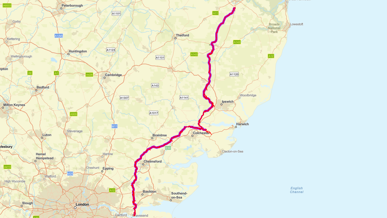
Norwich to Tilbury
Targeted consultations for Norwich to Tilbury
We’ve launched a targeted statutory consultation on proposed changes in Thurrock 3 running from Tuesday 18 March to 11:59 pm Thursday 17 April 2025.
Following our statutory consultation last summer, we have carefully reviewed all the feedback we received, and we have identified some locations where we could, potentially, make some small changes to the proposals we published last year. Most of these changes have been identified from the feedback we received, along with the consideration of the findings of environmental and engineering surveys. These potential changes do not materially change the effects or fundamentally change the project as a whole.
Before we make any decisions, we are going back to consult with those people living near these proposed changes. We are writing to nearby residents and community representatives to explain the proposed changes and give them the opportunity to provide feedback.
We’ve phased these consultations, starting with locations in Norfolk and Suffolk followed by locations in Essex and Thurrock.
Targeted consultations on proposed changes in Norfolk and Suffolk took place between Monday 30 January and Monday 3 March 2025.
Targeted changes in Essex and Thurrock took place between Tuesday 25 February and Thursday 27 March 2025.
We are consulting on Thurrock 3 – proposed changes to connection at Tilbury between Tuesday 18 March and 17 April 2025.
While these are local, targeted consultations anyone can take part, and more information on the proposed changes is available below. You can take part either by emailing us, writing to us using our Freepost address or via the online questionnaire here.
Thurrock 3: proposed changes to connection at Tilbury
We are holding a targeted statutory consultation where we are considering changes to the project presented to the public at the statutory consultation in summer 2024.
Since the close of the statutory consultation in 2024, we have reviewed and considered all consultation feedback and continued to carry out further assessments and survey work to inform our proposals. As a result, we are now considering making some changes to our proposals at a number of locations, including some proposed changes to the connection at Tilbury. These potential changes do not materially change the effects or fundamentally change the project as a whole.
These proposed changes would reduce the length of the underground cabling and replace a previously proposed cable sealing end (CSE) compound with a substation. We are also proposing some additional works to the existing infrastructure in the area including modifications to the existing overhead lines - to enable the electrical connection into the existing Tilbury Substation via the new substation.
We intend to submit our application for development consent for the Norwich to Tilbury project in summer 2025. Before we finalise our proposals, we want to give nearby residents and local communities the opportunity to provide feedback on proposed changes at this location.
We are consulting on these proposed changes between 18 March and 17 April 2025 and we welcome your feedback. You can find more information on this change in the March 2025 targeted consultation section below.
Providing feedback
If you would like to comment on any of the proposed changes, you can send feedback via our online feedback questionnaire or write or email us using the contact details below:
Email - [email protected]
Freepost – FREEPOST N TO T
Online feedback questionnaire - click here
Each location has been given a reference, please quote this in any correspondence.
Webinars and events
Events
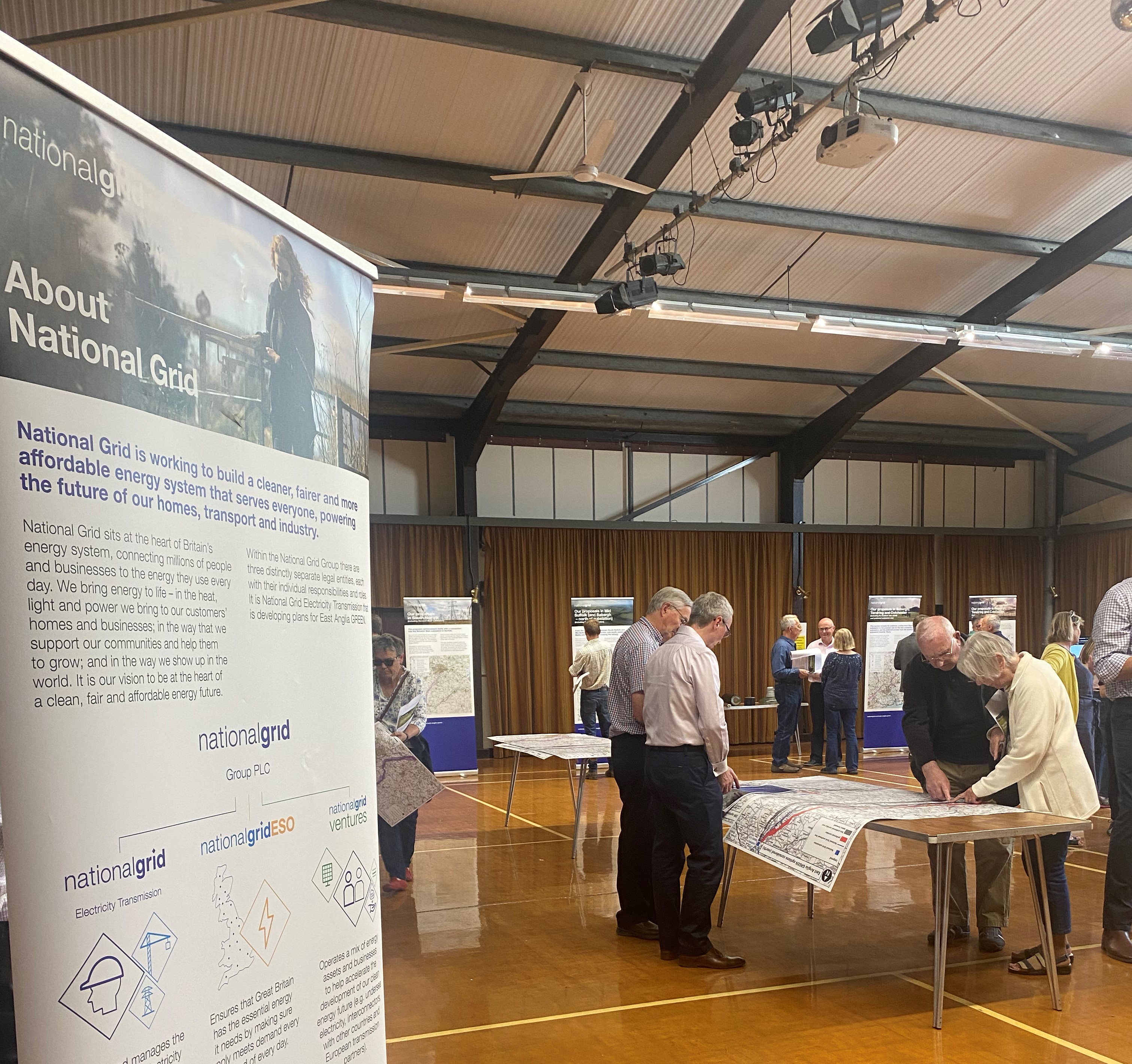
We held two public information events to give local residents the opportunity to view our proposals and speak to members of the Project team.
Tuesday 25 March – Chadwell St Mary Village Hall, 10:30am -3:30pm
Thursday 27 March – West Tilbury Village Hall, 11:30am - 4:30pm
Attend a webinar
We’re holding two webinars on Thurrock 3 via Microsoft Teams to give people an opportunity to ask the project team questions.
You can sign up for a webinar by clicking on one of the links below:
January 2025 targeted consultations on proposed changes in Norfolk and Suffolk
Our targeted consultations on proposed changes in Norfolk and Suffolk took place between 12 noon 30 January 2025 and 11:59pm 3 March 2025.
Whilst these consultations have now concluded, you can still view information on these change below.
What we are proposing to change in your area and why
We are proposing changes to the location of the temporary construction laydown areas on the land around Norwich Main substation and related haul roads. This includes moving the temporary construction laydown areas to land west of pylons RG3 and RG5.
These proposed changes would allow our proposals to avoid conflicting with the construction of other proposed developments in the area.
We are also proposing other changes to the temporary works to accommodate the positioning of soil storage and associated landscaping works at Norwich Main substation, as well as other minor amendments to the order limits.
For more information and to see a map of these changes, you can view our consultation leaflet here.
What are the environmental implications of the proposed changes?
The proposed changes would not materially change the conclusions that were reported within the Preliminary Environmental Information Report (PEIR) published as part of our summer 2024 consultation.
For more information on environmental implications, please see the Environmental Implications of Change document (EIC) with location reference Norfolk 1, where information on the environmental implications of the proposed change is provided and can be read alongside the information contained here.
If, following careful consideration of any feedback we receive, we decide to make this change, baseline information, environmental surveys and assessments associated with this change will be provided in the Environmental Statement (ES) that will form part of our application for a Development Consent Order (DCO).
What we are proposing to change in your area and why
We are proposing to move a line of pylons near Forncett St Mary to the west of its previous location. The proposed change would affect the location of the pylons between RG30 and RG39.
This change is being proposed following feedback which asked us to consider if we could:
- reduce potential effects on a site used for flying model aircraft
- reposition the alignment more centrally between residential properties on Northfield Road
- move pylons to field boundaries where practicable.
The proposed change in alignment would include RG30 and RG33 becoming angle pylons to help reduce the impacts on the site used for flying model aircraft. Angle pylons are used where the route changes direction. These pylons may be heavier and need larger foundations to carry the stresses of the change of direction.
We also considered repositioning the pylons to the east of the previous route, but this would make the route longer and need more angle pylons, which could increase the visual impact.
Our proposed change would also move pylon RG39 closer to a field boundary and adjust the alignment closer to the mid-point between properties along Northfield Road. To accommodate this change in alignment, we are proposing to move the haul road and the bellmouths – where project traffic would cross public highways or enter the project site - along with other minor amendments to the order limits.
The crossing at Stickfer Lane would move north-west to Hurn Lane in order to follow the pylon alignment, the bellmouth on Cheney’s Lane would shift to the east, and the crossing on Northfield Road would move west.
For more information and to see a map of these changes, you can view our consultation leaflet here.
What are the environmental implications of the proposed changes?
The proposed changes would not materially change the conclusions that were reported within the Preliminary Environmental Information Report (PEIR) published as part of our summer 2024 consultation.
For more information on environmental implications, please see the Environmental Implications of Change document (EIC) with location reference Norfolk 2, where information on the environmental implications of the proposed change is provided and can be read alongside the information contained here.
If, following careful consideration of any feedback we receive, we decide to make this change, baseline information, environmental surveys and assessments associated with this change will be provided in the Environmental Statement (ES) that will form part of our application for a Development Consent Order (DCO).
What we are proposing to change in your area and why
We are proposing to reposition a line of pylons between Tibenham and Bunwell Hill to the west of the location that was proposed at our statutory consultation in summer 2024. The proposed change would affect the location of the pylons between RG46 and RG52.
This change is being proposed in response to consultation feedback which asked us to consider:
- avoiding a veteran tree and active Honey Bee population
- using existing tracks for access to reduce impact on arable land
- reducing effects on an area of grassland considered particularly important to farm activities.
We are proposing that pylons RG48 and RG49 would be relocated roughly 60 m to the west of the location presented at statutory consultation in 2024, and associated pylons to the north and south would also be slightly adjusted. This would also avoid a veteran tree. To accommodate this change, pylon RG48 would become an angle pylon. Angle pylons are used where the route changes direction. These pylons may be heavier and need larger foundations to carry the stresses of the change of direction.
This proposed change would also require several changes to related temporary and permanent accesses - along with other minor amendments to the order limits. The proposed permanent access would use a longer stretch of Brick Kiln Lane and, instead of creating a new access off to the east through farmland, would make use of an existing track, which is located along the northern edge of existing woodland.
We would also reposition the haul road to follow this amended alignment. The haul road alongside RG48 and RG49 would be repositioned west to an area of the woodland which was previously cleared. This would allow the haul road to avoid a field used for livestock over-wintering and would limit the amount of tree removal required. The temporary access to the north and south would also be repositioned to follow the alignment. This would move the bellmouth where project traffic would cross the lane leading to Old Hall to a location 100 m further east from the location presented at statutory consultation in summer 2024.
We are also proposing to amend our proposals to replace a section of the existing lower voltage electricity overhead line with underground cables. The removal of the wooden poles between RG48 and RG49 would be extended further north to the field boundary, with more wooden poles remaining to the south than was proposed at our statutory consultation in summer 2024. The proposed underground cables would follow field boundaries and the haul road alignment to minimise the need for tree removal.
For more information and to see a map of these changes, you can view our consultation leaflet here.
What are the environmental implications of the proposed changes?
The proposed changes would not materially change the conclusions that were reported within the Preliminary Environmental Impact Report (PEIR) published as part of our summer 2024 consultation.
For more information on environmental implications, please see the Environmental Implications of Change document (EIC) with location reference Norfolk 3, where information on the environmental implications of the proposed change is provided and can be read alongside the information contained here
If, following careful consideration of any feedback we receive, we decide to make this change, baseline information, environmental surveys and assessments associated with this change will be provided in the Environmental Statement (ES) that will form part of our application for a Development Consent Order (DCO).
What we are proposing to change in your area and why
We are proposing to relocate a temporary construction laydown area near Winfarthing, to the south of the location that was proposed at our statutory consultation in summer 2024. The temporary laydown area would be relocated south of the B1134 close to RG58. The proposed change would not affect the overhead alignment.
This change is being proposed following consideration of the findings from geophysics surveys in spring 2024 which identified important buried heritage assets on the land to the north of the B1134.
Access for the temporary construction laydown area would still be from the B1134, as was presented at our statutory consultation in summer 2024. We are also proposing other minor amendments to the order limits.
For more information and to see a map of these changes, you can view our consultation leaflet here.
What are the environmental implications of the proposed changes?
The proposed change would not materially change the conclusions that were reported within the Preliminary Environmental Impact Report (PEIR) published as part of our summer 2024 consultation.
For more information on environmental implications, please see the Environmental Implications of Change document (EIC) with location reference Norfolk 4, where information on the environmental implications of the proposed change is provided and can be read alongside the information contained here.
If, following careful consideration of any feedback we receive, we decide to make this change, baseline information, environmental surveys and assessments associated with this change will be provided in the Environmental Statement (ES) that will form part of our application for a Development Consent Order (DCO).
What we are proposing to change in your area and why
We are proposing to reposition a line of pylons between Palgrave and Mellis to the south-east of the location that was proposed at our statutory consultation in summer 2024.
This would affect the pylons between RG94 and RG102 (previously presented at statutory consultation as RG095 and RG102).
This is in response to consultation feedback which asked us to consider if we could:
- adjust the alignment to follow more of the existing 32kV route for a longer distance to reduce visual effects
- remove more of the 132kV overhead line to reduce cumulative effects
- reposition pylons to reduce potential effects on an airstrip.
The proposed change would include removing approximately a further 2 km of the 132 kV pylon line and replacing it with underground cable (with the total length of underground cable increased to around 5 km in this section), routed where possible to follow field boundaries. This would allow pylons RG95 to RG101 to more closely follow the alignment of the existing 132 kV line. This would reduce visual impact through positioning of the line using existing trees to screen views. We propose that from RG94 (previously presented during statutory consultation as RG095), the line would go south before turning southwest and following the existing 132kV line alignment before connecting to RG102 at a slightly reduced angle.
This change would reduce visual impact on nearby properties and allow flight activity at the nearby airstrip to continue.
Alongside the alignment shift, the proposed change would also require amendments to temporary and permanent access arrangements along with other minor amendments to the order limits. We are proposing to reposition the temporary construction compound and the associated construction access further north towards the A143.
To accommodate this proposed change in alignment, we are also proposing to move the haul road and the bellmouths - where project traffic would cross public highways or enter the project site. We’re now proposing to reposition the bellmouth that would cross the A143 Old Bury Road to the east of its previously proposed location.
The temporary construction compound for undergrounding the UK Power Networks (UKPN) line would be accessed via the A143 Old Bury Road (identified as Primary Access Routes H05-A2 and H06-A1 in the previous statutory consultation).
For more information and to see a map of these changes, you can view our consultation leaflet here.
What are the environmental implications of the proposed changes?
The proposed changes would not materially change the conclusions that were reported within the Preliminary Environmental Information Report (PEIR) published as part of our summer 2024 consultation.
For more information on environmental implications, please see the Environmental Implications of Change document (EIC) with location reference Suffolk 1, where information on the environmental implications of the proposed change is provided and can be read alongside the information contained here.
If, following careful consideration of any feedback we receive, we decide to make this change, baseline information, environmental surveys and assessments associated with this change will be provided in the Environmental Statement (ES) that will form part of our application for a Development Consent Order (DCO).
What we are proposing to change in your area and why
We are proposing to reposition a line of pylons between Palgrave and Mellis to the south-east of the location that was proposed at our statutory consultation in summer 2024.
This would affect the pylons between RG94 and RG102 (previously presented at statutory consultation as RG095 and RG102).
This is in response to consultation feedback which asked us to consider if we could:
- adjust the alignment to follow more of the existing 32kV route for a longer distance to reduce visual effects
- remove more of the 132kV overhead line to reduce cumulative effects
- reposition pylons to reduce potential effects on an airstrip.
The proposed change would include removing approximately a further 2 km of the 132 kV pylon line and replacing it with underground cable (with the total length of underground cable increased to around 5 km in this section), routed where possible to follow field boundaries. This would allow pylons RG95 to RG101 to more closely follow the alignment of the existing 132 kV line. This would reduce visual impact through positioning of the line using existing trees to screen views. We propose that from RG94 (previously presented during statutory consultation as RG095), the line would go south before turning southwest and following the existing 132kV line alignment before connecting to RG102 at a slightly reduced angle.
This change would reduce visual impact on nearby properties and allow flight activity at the nearby airstrip to continue.
Alongside the alignment shift, the proposed change would also require amendments to temporary and permanent access arrangements along with other minor amendments to the order limits. We are proposing to reposition the temporary construction compound and the associated construction access further north towards the A143.
To accommodate this proposed change in alignment, we are also proposing to move the haul road and the bellmouths - where project traffic would cross public highways or enter the project site. We’re now proposing to reposition the bellmouth that would cross the A143 Old Bury Road to the east of its previously proposed location.
The temporary construction compound for undergrounding the UK Power Networks (UKPN) line would be accessed via the A143 Old Bury Road (identified as Primary Access Routes H05-A2 and H06-A1 in the previous statutory consultation).
For more information and to see a map of these changes, you can view our consultation leaflet here.
What are the environmental implications of the proposed changes?
The proposed changes would not materially change the conclusions that were reported within the Preliminary Environmental Information Report (PEIR) published as part of our summer 2024 consultation.
For more information on environmental implications, please see the Environmental Implications of Change document (EIC) with location reference Suffolk 1a, where information on the environmental implications of the proposed change is provided and can be read alongside the information contained here.
If, following careful consideration of any feedback we receive, we decide to make this change, baseline information, environmental surveys and assessments associated with this change will be provided in the Environmental Statement (ES) that will form part of our application for a Development Consent Order (DCO).
What we are proposing to change in your area and why
We are proposing to reposition the overhead line alignment further away from the village of Gislingham and to the west of the railway track. The proposed change would affect the location of the pylons between RG114 and RG119 (previously presented at statutory consultation as RG114 to RG118).
This is in response to consultation feedback which asked us to consider:
- moving the angle tower pylon and alignment of RG114 to RG118 further away from residential properties to the northern and eastern edges of the village
- the impact of the alignment on veteran trees between Thornham Road and Coldham Lane
- wider ecological concerns related to the alignment.
The proposed change involves the addition of one pylon, and the relocation of the angle tower further east to increase its distance from residential properties.
We also considered moving the pylons to the west of the village, but this would increase impacts arising from proximity to properties.
This proposed alignment change would result in the angle tower being positioned behind an established woodland, which would provide screening to the closest properties. As a result of the proposed alignment change, we are also proposing to reposition the construction compound to the north of Thornham Road to allow for better screening and reduce potential impacts on veteran trees. For more information on the construction access plans we presented at our statutory consultation, please visit our document library. A change to the proposed permanent access route for light maintenance activities would also follow the repositioned alignment.
To accommodate the proposed change in alignment, we are also proposing to move two bellmouths in the area - where project traffic would cross public highways or enter the project site - along with other minor amendments to the order limits. This includes the movement of the bellmouth on Burgate Road 110 m further south than was proposed at statutory consultation, and on Major Lane 200 m further east.
For more information and to see a map of these changes, you can view our consultation leaflet here.
What are the environmental implications of the proposed changes?
The proposed changes would not materially change the conclusions that were reported within the Preliminary Environmental Information Report (PEIR) published as part of our summer 2024 consultation.
For more information on environmental implications, please see the Environmental Implications of Change document (EIC) with location reference Suffolk 2, where information on the environmental implications of the proposed change is provided and can be read alongside the information contained here.
If, following careful consideration of any feedback we receive, we decide to make this change, baseline information, environmental surveys and assessments associated with this change will be provided in the Environmental Statement (ES) that will form part of our application for a Development Consent Order (DCO).
What we are proposing to change in your area and why
We are proposing to move a line of pylons near Cay Hill to the west of the location that was proposed at our statutory consultation in summer 2024. This proposed change would affect the locations of the pylons between RG136 and RG142 (previously presented at statutory consultation as RG135 to RG141).
This is in response to consultation feedback which asked us to consider if we could:
- reposition the proposed alignment to reduce tree removal and increase the distance from residential properties
- use field edges to route diversions for lower voltage electricity lines to reduce potential effects on an area of perceived ecological interest
- use field edges or existing tracks for temporary and permanent works access where practicable.
Moving these pylons to the west would increase the distance to properties without the need to materially lengthen the route or introduce any additional angle pylons. The pylons would also be located to the edge of main sight lines from some properties compared with the alignment presented at statutory consultation in 2024.
We considered other adjustments to the alignment including paralleling the existing overhead line to the east, but these would make the route longer to varying extents, present technical risks for construction and future maintenance, place the alignment on slightly higher ground, increase the need for more angle pylons, and increase effects for some residential properties. For these reasons these other adjustments were less preferable.
This proposed change also allows us to relocate the temporary access arrangements in this location to more closely follow field boundaries except where it would be unsafe to do so. We are also proposing to modify the diversions of lower voltage electricity connections to follow field edges, along with other minor amendments to the order limits.
To accommodate this proposed change, we are also proposing to reposition the haul road and the bellmouths. The crossing over the unnamed lane north of RG137 (previously RG136) which was proposed at statutory consultation in 2024 would move to the west, and the former crossing on Lamberts Lane would move to follow the proposed alignment, crossing Lamberts Lane to the north-west near Elden’s Lane.
For more information and to see a map of these changes, you can view our consultation leaflet here.
What are the environmental implications of the proposed changes?
The proposed changes would not materially change the conclusions that were reported within the Preliminary Environmental Information Report (PEIR) published as part of our summer 2024 consultation.
For more information on environmental implications, please see the Environmental Implications of Change document (EIC) with location reference Suffolk 3, where information on the environmental implications of the proposed change is provided and can be read alongside the information contained here.
If, following careful consideration of any feedback we receive, we decide to make this change, baseline information, environmental surveys and assessments associated with this change will be provided in the Environmental Statement (ES) that will form part of our application for a Development Consent Order (DCO).
What we are proposing to change in your area and why
We are proposing to add a temporary 132 kV construction compound near Needham Market to facilitate the undergrounding of the existing UK Power Networks (UKPN) 132 kV overhead line.
The proposed change would introduce a new construction compound near pylon RG173 (previously presented at statutory consultation as RG172) but would not affect the proposed location of the overhead line as presented at statutory consultation.
The map showing our proposed changes (included within consultation leaflet Suffolk 4) also shows an extended access route. This is an update in line with information on public highway boundaries and is not a change to the access route proposed at our statutory consultation in summer 2024.
It is proposed that this access route would remain the permanent access route for inspection and light maintenance, as presented at statutory consultation.
We are proposing that construction traffic for the 132 kV undergrounding works would access the site via Hill House Lane and connect to the B1113 Stowmarket Road. The B1113 forms part of Primary Access Route H10-A1, as presented in the previous statutory consultation.
Construction access for the Norwich to Tilbury overhead line would remain via the temporary construction haul road, as presented at statutory consultation.
For more information and to see a map of these changes, you can view our consultation leaflet here.
What are the environmental implications of the proposed changes?
The proposed change would not materially change the conclusions that were reported within the Preliminary Environmental Information Report (PEIR) published as part of our summer 2024 consultation.
For more information on environmental implications, please refer to the Environmental Implications of Change document (EIC) with location reference Suffolk 4, where information on the environmental implications of the proposed change is provided and can be read alongside the information contained here.
If, following careful consideration of any feedback we receive, we decide to make this change, baseline information, environmental surveys and assessments associated with this change will be provided in the Environmental Statement (ES) that will form part of our application for a Development Consent Order (DCO).
What we are proposing to change in your area and why
We are proposing to reposition the route for 132kV underground cables near Offton. The new route would follow field boundaries more closely that was proposed at our statutory consultation in summer 2024.
This change is proposed in response to consultation feedback which asked us to consider:
- following field boundaries where practicable to reduce impacts on agricultural activity and avoid fields otherwise unaffected by works.
This 132 kV underground cable route would replace the existing 132 kV pylons that are owned by UKPN. We need to take down the UKPN pylons to accommodate the Norwich to Tilbury overhead line.
For more information and to see a map of these changes, you can view our consultation leaflet here.
What are the environmental implications of the proposed changes?
The proposed change would not materially change the conclusions that were reported within the Preliminary Environmental Information Report (PEIR) published as part of our summer 2024 consultation.
For more information on environmental implications, please refer to the Environmental Implications of Change document (EIC) with location reference Suffolk 5, where information on the environmental implications of the proposed change is provided and can be read alongside the information contained here.
If, following careful consideration of any feedback we receive, we decide to make this change, baseline information, environmental surveys and assessments associated with this change will be provided in the Environmental Statement (ES) that will form part of our application for a Development Consent Order (DCO).
What we are proposing to change in your area and why
We are proposing to reposition the underground cable alignment near Raydon to the east of the location that was presented in summer 2024, and near Manor Farm to the south east of the location presented at our statutory consultation. We are also proposing to reposition the temporary works access and compound near Holton St Mary to avoid passing through the centre of the village.
This is in response to consultation feedback which asked us to consider:
- reducing impacts on residential properties
- lessening impacts on agricultural activities by reducing the number of fields crossed
- moving the cable further away from water pipelines
- reducing the impact of heavy goods vehicles (HGVs) and large loads traffic through Holton St Mary.
The proposed change would result in the underground cables passing to the east of Wenham Grove and allowing for more extensive screening of the Cable Sealing End compound’ (CSE) through more effective planting. The alignment would move closer to Manor Farm and Bottle Bridge Cottages, where there would be some temporary construction effects.
The proposed change would lessen the impact on agricultural activity by reducing the number of fields affected by construction, compared to the previous proposal. The proposed change would also include moving the underground cabling at the south east of Raydon to reduce effects on residential properties, along with other minor amendments to the order limits.
We are proposing a temporary construction access road which would turn off the B1070 to the east of Holton St Mary via a new bellmouth. It would cross agricultural fields to the north of the village to access the construction compound located to the northwest near Raydon. The proposed route would reduce the effects of construction HGVs at Holton St Mary and follow field boundaries where possible to reduce agricultural impacts.
For more information and to see a map of these changes, you can view our consultation leaflet here.
What are the environmental implications of the proposed changes?
The proposed changes would not materially change the conclusions that were reported within the Preliminary Environmental Information Report (PEIR) published as part of our summer 2024 consultation.
For more information on environmental implications, please see the Environmental Implications of Change document (EIC) with location reference Suffolk 6, where information on the environmental implications of the proposed change is provided and can be read alongside the information contained here.
If, following careful consideration of any feedback we receive, we decide to make this change, baseline information, environmental surveys and assessments associated with this change will be provided in the Environmental Statement (ES) that will form part of our application for a Development Consent Order (DCO).
February 2025 targeted consultations on proposed changes in Essex and Thurrock
Our targeted consultations on proposed changes in Essex and Thurrock ran from Tuesday 25 February to 11:59 pm on Thursday 27 March 2025.
Whilst these consultations have now concluded, you can still view information on these change below.
What we are proposing to change in your area and why
We are proposing to reposition the underground cable route near Langham to the west of the previous alignment proposed at statutory consultation in summer 2024.
We are proposing this change in response to consultation feedback which asked us to consider:
- reducing impact on areas of mature woodland and the associated protected species
- minimising impact on rural business activities
- avoiding the removal of trees along tree lined access roads where practicable.
The proposed alignment would divert west after crossing the River Stour, avoiding parts of the Langham Hall Estate, and continue southwest before turning southeast near Alderton’s Cottages and rejoining the route presented at statutory consultation in summer 2024 to the north of Black Brook.
The proposed change would remove the need for one section of trenchless crossing near Langham Church, reduce disturbance to wildlife and mature woodland, and would reduce tree removal along a number of tree lined avenues.
To accommodate the change, we are also proposing to reposition the haul road and the bellmouths, where project traffic would cross public highways or enter the project site, from the locations presented at statutory consultation in summer 2024. The haul road would follow the new proposed alignment, with project traffic crossing the unnamed track northwest of Whalebone Corner. The haul road and bellmouths associated with the compound west of Ipswich Road would remain as presented previously.
We are also proposing other minor amendments to the order limits as well as repositioning the temporary construction compound and laydown area.
For more information and to see a map of these changes, you can view our consultation leaflet here.
What are the environmental implications of the proposed changes?
The proposed changes would not materially change the conclusions that were reported within the Preliminary Environmental Information Report (PEIR) published as part of our summer 2024 consultation.
For more information on environmental implications, please see the Environmental Implications of Change document (EIC) with location reference Essex 1, where information on the environmental implications of the proposed change is provided and can be read alongside the information contained here.
If, following careful consideration of any feedback we receive, we decide to make this change, baseline information, environmental surveys and assessments associated with this change will be provided in the Environmental Statement (ES) that will form part of our application for a Development Consent Order (DCO).
What we are proposing to change in your area and why
We are proposing to reposition the underground cable and overhead line alignments before they enter the East Anglia Connection Node (EACN) substation east of Ardleigh. The proposed change would not affect the location of the underground cable or the overhead line at the substation.
This change is being proposed in response to consultation feedback which asked us to consider:
- the potential outcome of consultation on the Essex Mineral Plan which could see land to the south of Little Bromley Road allocated as a site for silica sand extraction
- potential effects on fishing and horticulture to the north of Little Bromley Road.
The proposed change would locate the underground cables predominantly to the north of Little Bromley Road and passing to the south of the lake at Home Farm, with the overhead line to the south of the road. Use of the lake and its immediate surroundings (beyond the construction area) would not be restricted, though the proposed repositioning of the cable would increase the impact on horticultural land during the construction stage, as a wider swathe of land would need to be cleared. However, once site restoration is complete, horticultural uses could be reestablished.
The proposed change in alignment, compared to the design presented at statutory consultation, would introduce an additional angle pylon and pass closer to properties along Morrow Lane. Vegetation loss and effects on recreation at the lake would be reduced.
To accommodate the proposed change in alignment, we are also proposing to move the associated haul road and bellmouth - where construction traffic would cross public highways or enter the project site - from its location as presented at statutory consultation in summer 2024. We are proposing an additional bellmouth on Home Farm Lane, and the bellmouth on Morrow Lane would be moved 20 m further south of the location previously proposed at statutory consultation in summer 2024 to facilitate construction access to the site.
We are also proposing other minor amendments to the order limits, including repositioning the temporary construction compound to the east.
For more information and to see a map of these changes, you can view our consultation leaflet here.
What are the environmental implications of the proposed changes?
The proposed changes would not materially change the conclusions that were reported within the Preliminary Environmental Information Report (PEIR) published as part of our summer 2024 consultation.
For more information on environmental implications, please see the Environmental Implications of Change document (EIC) with location reference Essex 2, where information on the environmental implications of the proposed change is provided and can be read alongside the information contained here.
If, following careful consideration of any feedback we receive, we decide to make this change, baseline information, environmental surveys and assessments associated with this change will be provided in the Environmental Statement (ES) that will form part of our application for a Development Consent Order (DCO).
What we are proposing to change in your area and why
We are proposing to reposition a section of permanent private access near Little Bromley, to the south of the location proposed at our statutory consultation in summer 2024. This access is the proposed permanent access to the East Anglia Connection Node (EACN) substation near Ardleigh. Traffic would continue to join Bentley Road and Ardleigh Road in the previously proposed locations.
This change is being proposed in response to landowner feedback asking us to consider moving the track to follow the edge of a landholding. The proposed plans move the section of permanent private access closer to this boundary and avoids crossing a larger field.
For more information and to see a map of these changes, you can view our consultation leaflet here.
What are the environmental implications of the proposed changes?
The proposed changes would not materially change the conclusions that were reported within the Preliminary Environmental Information Report (PEIR) published as part of our summer 2024 consultation. For more information on environmental implications, please see the Environmental Implications of Change document (EIC) with location reference Essex 3, where information on the environmental implications of the proposed change is provided and can be read alongside the information contained here.
If, following careful consideration of any feedback we receive, we decide to make this change, baseline information, environmental surveys and assessments associated with this change will be provided in the Environmental Statement (ES) that will form part of our application for a Development Consent Order (DCO).
What we are proposing to change in your area and why
We are proposing to reposition the temporary construction access on Wick Lane near Ardleigh, to the west of the location proposed at our statutory consultation in summer 2024.
This change is being proposed in response to consultation feedback which asked us to consider repositioning the access in order to reduce its impact on a property.
The proposed location would continue to meet highway safety standards and ensure construction traffic could safely leave and access the proposed haul road. We are also proposing to reposition the haul road to use this relocated temporary construction access, as well as other minor amendments to the order limits.
For more information and to see a map of these changes, you can view our consultation leaflet here.
What are the environmental implications of the proposed changes?
The proposed changes would not materially change the conclusions that were reported within the Preliminary Environmental Information Report (PEIR) published as part of our summer 2024 consultation.
For more information on environmental implications, please see the Environmental Implications of Change document (EIC) with location reference Essex 4, where information on the environmental implications of the proposed change is provided and can be read alongside the information contained here.
If, following careful consideration of any feedback we receive, we decide to make this change, baseline information, environmental surveys and assessments associated with this change will be provided in the Environmental Statement (ES) that will form part of our application for a Development Consent Order (DCO).
What we are proposing to change in your area and why
We are proposing to reposition a line of pylons near Surrex, to the east of the position presented at our statutory consultation in summer 2024. The proposed change would affect the location of the pylons TB71 to TB75 (previously presented at statutory consultation in summer 2024 as TB071 to TB074).
This is in response to consultation feedback which asked us to consider:
- increasing distance from residential properties
- changing the haul road to avoid isolating horse paddocks
- reducing the effect of the scaffolding requirements where the line would cross the A120.
The proposed change would include the addition of one further angle pylon to position the line more evenly between residential properties in the settlement of Surrex and the residential properties at Skye Green. This would remove the need for the haul road to cross the horse paddocks to the south of Surrex. We are also proposing to change the haul roads associated with these pylons so that they follow field boundaries where possible, reducing the impacts on land uses and agricultural activity, along with other minor amendments to the order limits.
To accommodate the proposed repositioning of pylons, we are also proposing to move the bellmouth on Old Road, where project traffic would cross the road, to the east of the location we presented at statutory consultation in summer 2024. This would facilitate access to the construction sites for the relocated pylons.
For more information and to see a map of these changes, you can view our consultation leaflet here.
What are the environmental implications of the proposed changes?
The proposed change would not materially change the conclusions that were reported within the Preliminary Environmental Information Report (PEIR) published as part of our summer 2024 consultation.
For more information on environmental implications, please refer to the Environmental Implications of Change document (EIC) with location reference Essex 5, where information on the environmental implications of the proposed change is provided and can be read alongside the information contained here.
If, following careful consideration of any feedback we receive, we decide to make this change, baseline information, environmental surveys and assessments associated with this change will be provided in the Environmental Statement (ES) that will form part of our application for a Development Consent Order (DCO).
What we are proposing to changein your area and why
In response to feedback from statutory consultation in summer 2024, we are proposing to reposition a line of pylons near Feering, further to the southeast. The proposed change would affect the location of the pylons between TB77 and TB81 (previously presented at statutory consultation as TB076 and TB079).
To reduce close views of pylon TB78 (previously TB077) from nearby homes, it would be positioned to the southeast of its previous location, on lower ground, and would become an angle pylon. The alignment would then run west, including an additional pylon to facilitate the proposed repositioning of TB78. TB80 (previously TB078) would also shift to the south, connecting to TB81 (previously TB079) at a slight angle.
The proposed pylon positioning would maintain the field edge positioning presented in the draft alignment presented at statutory consultation in 2024. Access arrangements would also use existing tracks and field boundaries as far as practicable.
To accommodate this proposed change in alignment, we are also proposing to make changes to the haul road and the bellmouths – where project traffic would cross public highways or enter the project site. The crossing on Coggeshall Road (Feering) would be repositioned slightly to the north of where it was proposed at statutory consultation in 2024, and the crossing over the B1024 Coggeshall Road would move 130 m south. We are also proposing a new cross over bellmouth on Old Mill Lane, along with other minor amendments to the order limits.
For more information and to see a map of these changes, you can view our consultation leaflet here.
What are the environmental implications of the proposed changes?
The proposed changes would not materially change the conclusions that were reported within the Preliminary Environmental Information Report (PEIR) published as part of our summer 2024 consultation.
For more information on environmental implications, please see the Environmental Implications of Change document (EIC) with location reference Essex 6, where information on the environmental implications of the proposed change is provided and can be read alongside the information contained here.
If, following careful consideration of any feedback we receive, we decide to make this change, baseline information, environmental surveys and assessments associated with this change will be provided in the Environmental Statement (ES) that will form part of our application for a Development Consent Order (DCO).
What we are proposing to change in your area and why
We are proposing to extend the project order limits south of Great Leighs, between pylons TB128 and TB133 (previously presented as TB126 to TB131).
We are proposing this change as Essex County Council has recently consulted on its draft updated Essex Minerals Plan and identified that this land could be allocated as a mineral site.
Extending the project order limits in this area to the south east would allow for flexibility if the site is allocated in the updated Essex Minerals Plan.
We are also proposing other minor amendments to the order limits, including repositioning the temporary construction laydown area.
For more information and to see a map of these changes, you can view our consultation leaflet here.
What are the environmental implications of the proposed changes?
The proposed changes would not materially change the conclusions that were reported within the Preliminary Environmental Information Report (PEIR) published as part of our summer 2024 consultation.
For more information on environmental implications, please see the Environmental Implications of Change document (EIC) with location reference Essex 7, where information on the environmental implications of the proposed change is provided and can be read alongside the information contained here.
If, following careful consideration of any feedback we receive, we decide to make this change, baseline information, environmental surveys and assessments associated with this change will be provided in the Environmental Statement (ES) that will form part of our application for a Development Consent Order (DCO).
Essex 8
What we are proposing to change in your area and why
We are proposing to change the alignment of pylons between Great Waltham and Little Waltham. In the same area, we are also proposing to change the pylon design from full height lattice pylons to lower height lattice pylons. There is an illustrative image of a low-height lattice pylon within our consultation leaflet available here.
This change is being proposed following feedback received at our statutory consultation in summer 2024, which asked us to consider reducing the visual impact of the pylons on conservation areas.
The proposed use of low height pylons is expected to remove or reduce the visibility of pylons from within the Great Waltham and Little Waltham conservation areas, and Langleys and associated park and garden.
While the new pylons would be shorter, they are also wider, potentially increasing the visual impact to properties within the immediate area.
We are also proposing adjustments to the alignment that was presented at our statutory consultation in summer 2024. This includes repositioning pylons between TB135 and TB142 (previously presented during statutory consultation as TB133 to TB140) to avoid veteran trees and protected species. This follows feedback received on the proposed positioning of the pylon to the south of the River Chelmer.
We are also proposing other minor amendments to the order limits.
For more information and to see a map of these changes, you can view our consultation leaflet here.
What are the environmental implications of the proposed changes?
The proposed change would not materially change the conclusions that were reported within the Preliminary Environmental Impact Report (PEIR) published as part of our summer 2024 consultation.
For more information on environmental implications, please see the Environmental Implications of Change document (EIC) with location reference Essex 8, where information on the environmental implications of the proposed change is provided and can be read alongside the information contained here.
If, following careful consideration of any feedback we receive, we decide to make this change, baseline information, environmental surveys and assessments associated with this change will be provided in the Environmental Statement (ES) that will form part of our application for a Development Consent Order (DCO).
Bookable sessions
If you would like to see how the changes we are proposing at this location may look in the landscape, you can book a session with the community relations team to view our 3D model at Great Waltham Village Hall on Friday 14 March between 6 pm and 8:30 pm, and Little Waltham Primary School on Saturday 15 March between 10 am and 2 pm.
You can book by contacting us on the following contact methods:
email us at: [email protected]
Call us on: 0800 915 2497.
What we are proposing to change in your area and why
We are proposing to move a temporary construction laydown area from a site close to Ivy Barns Lane to the north-west of the location proposed at our statutory consultation in summer 2024, in response to feedback from nearby residents.
The proposed change would not move the construction laydown area any closer to residential properties. The nearest residential property would benefit from improved screening from trees and vegetation as a result of the proposed change in location of the construction laydown area, compared to the screening available at the location proposed at statutory consultation in summer 2024.
For more information and to see a map of these changes, you can view our consultation leaflet here.
What are the environmental implications of the proposed changes?
The proposed changes would not materially change the conclusions that were reported within the Preliminary Environmental Information Report (PEIR) published as part of our summer 2024 consultation.
For more information on environmental implications, please see the Environmental Implications of Change document (EIC) with location reference Essex 9, where information on the environmental implications of the proposed change is provided and can be read alongside the information contained here.
If, following careful consideration of any feedback we receive, we decide to make this change, baseline information, environmental surveys and assessments associated with this change will be provided in the Environmental Statement (ES) that will form part of our application for a Development Consent Order (DCO).
What we are proposing to change in your area and why
We are proposing to take down a section of the existing 132 kV overhead line and replace it with underground cable to allow us to move a line of pylons and a temporary construction compound near Havering’s Grove to the west of its previous location. This would affect the pylons from TB208 to TB211 (previously presented at consultation as TB205 to TB208).
This is in response to consultation feedback which asked us to consider if we could:
- follow the route of the existing 132 kV overhead line or use underground cables for one of the overhead lines (either the existing 132 kV overhead line or the proposed 400 kV overhead line) to reduce cumulative effects
- increase the distance between residential properties and the proposed pylons and temporary construction compound.
The proposed change would replace approximately 2 km - from north of Bushwood Farm to south of Creasey’s Farmhouse - of the existing 132 kV overhead line with underground cable. This would reduce cumulative effects and facilitate the repositioning of the proposed 400 kV overhead line. We are proposing that TB206 would be repositioned to the west as angle pylon TB209 and that the line would turn southeast to reconnect with TB212 (previously TB209).
This proposed change would remove an angle pylon, reduce visual effects on nearby properties, and would also move further away from St James’ Wood Local Wildlife Site. It would avoid the need for tree removal around a pond to the west of St James’s Wood.
We are also proposing that the temporary construction laydown area is relocated to the west (into the next field) to increase the distance from the nearest residential properties. This compound would be accessed from the same location as previously proposed.
For more information and to see a map of these changes, you can view our consultation leaflet here.
What are the environmental implications of the proposed changes?
The proposed changes would not materially change the conclusions that were reported within the Preliminary Environmental Information Report (PEIR) published as part of our summer 2024 consultation.
For more information on environmental implications, please see the Environmental Implications of Change document (EIC) with location reference Essex 10, where information on the environmental implications of the proposed change is provided and can be read alongside the information contained here.
If, following careful consideration of any feedback we receive, we decide to make this change, baseline information, environmental surveys and assessments associated with this change will be provided in the Environmental Statement (ES) that will form part of our application for a Development Consent Order (DCO).
What we are proposing to change in your area and why
We are proposing to move a line of pylons near Little Burstead to the east of the alignment proposed at statutory consultation in 2024, and also make some adjustments to the haul road and access arrangements. This would affect the alignment of the pylons TB217 to TB220 (previously presented at statutory consultation as TB214 to TB217).
This is in response to consultation feedback which asked us to consider if we could:
- modify temporary and permanent access arrangements to the north and south of Botney Hill Road
- reposition pylons further from residential properties at Botney Hill.
We are proposing to reposition TB218 (previously TB215), so it is sited on lower ground to the south east as an angle pylon. Pylon TB217 (previously TB214) is now proposed to be changed from an angle pylon to a suspension pylon. The line would then continue from TB218 in a straight line to the southwest. This change has been proposed to reduce the impact on residential properties at Botney Hill.
We are proposing to reposition the haul road to the north east to follow field boundaries. We are also proposing to move the haul road crossing bellmouth to the existing farm access to the south of Botney Hill Road. This access is already used by HGVs. To allow HGVs to cross Botney Hill Road without needing to travel along it, the temporary bellmouth access to the north would also be repositioned directly opposite the existing farm access.
We are also proposing other minor amendments to the order limits.
For more information and to see a map of these changes, you can view our consultation leaflet here.
What are the environmental implications of the proposed changes?
The proposed changes would not materially change the conclusions that were reported within the Preliminary Environmental Information Report (PEIR) published as part of our summer 2024 consultation. For more information on environmental implications, please see the Environmental Implications of Change document with location reference Essex 11, where information on the environmental implications of the proposed change is provided and can be read alongside the information contained here.
If, following careful consideration of any feedback we receive, we decide to make this change, baseline information, environmental surveys and assessments associated with this change will be provided in the Environmental Statement (ES) that will form part of our application for a Development Consent Order (DCO).
What we are proposing to change in your area and why
We are proposing to reposition the temporary construction access and laydown area location near Dunton Wayletts to the south of its location presented at statutory consultation in summer 2024.
The proposed change would affect access to pylons TB225 and TB226 (previously presented at statutory consultation in summer 2024 as TB222 and TB223).
This change is being proposed following feedback which asked us to consider that future built development could be in the construction stage at the same time as the project and could therefore conflict with the proposed temporary access and compound arrangements presented at our statutory consultation in summer 2024.
The proposed change involves relocating the construction access road to TB226 (previously TB223), and a new construction laydown area for this pylon. The proposed laydown area would be temporary, and the land would be returned to its original use after construction.
As there is some uncertainty over the timing of the built development, we propose to include both access arrangements. Our preferred access route remains the northern access at TB225 presented at the 2024 statutory consultation. This proposed access arrangement would be used in the event that the land used for the northern access at TB225 is being developed and cannot be used.
For more information and to see a map of these changes, you can view our consultation leaflet here.
What are the environmental implications of the proposed changes?
The proposed changes would not materially change the conclusions that were reported within the Preliminary Environmental Information Report (PEIR) published as part of our summer 2024 consultation.
For more information on environmental effects, please see the Environmental Implications of Change document (EIC) with location reference Essex 12, where information on the environmental implications of the proposed change is provided and can be read alongside the information contained here.
If, following careful consideration of any feedback we receive, we decide to make this change, baseline information, environmental surveys and assessments associated with this change will be provided in the Environmental Statement (ES) that will form part of our application for a Development Consent Order (DCO).
What we are proposing to change in your area and why
We are proposing to reposition the existing UK Power Networks (UKPN) 132 kV line close to Lower Dunton Road. This 132 kV connection is currently above ground and carried on lattice pylons but, to allow Norwich to Tilbury to come forward, it would need to be moved and placed underground. In our summer 2024 statutory consultation, we presented an underground route for the 132 kV connection. We are now proposing to reposition this underground route to follow more closely follow existing field boundaries on either side of Lower Dunton Road.
This change is being proposed following feedback received at our statutory consultation in summer 2024, which asked us to consider the impacts on farming and to take account of housing development proposals.
To facilitate these works, we are also proposing temporary UKPN compounds at each end of the undergrounding route, which would be accessed via Lower Dunton Road. We are also proposing other minor amendments to the order limits.
For more information and to see a map of these changes, you can view our consultation leaflet here.
What are the environmental implications of the proposed changes?
The proposed changes would not materially change the conclusions that were reported within the Preliminary Environmental Information Report (PEIR) published as part of our summer 2024 consultation.
For more information on environmental effects, please see the Environmental Implications of Change document with location reference Essex 13, where information on the environmental implications of the proposed change is provided and can be read alongside the information contained here.
If, following careful consideration of any feedback we receive, we decide to make this change, baseline information, environmental surveys and assessments associated with this change will be provided in the Environmental Statement (ES) that will form part of our application for a Development Consent Order (DCO).
What we are proposing to change in your area and why
We are proposing to reposition a temporary construction compound near Dunton to the east.
This change is being proposed following a request from the landowner to move the construction compound from the western end of the field to the eastern end of the field to reduce effects on agricultural activity.
The construction haul road would be extended to the east to allow access to the new construction compound.
For more information and to see a map of these changes, you can view our consultation leaflet here.
What are the environmental implications of the proposed changes?
The proposed change would not materially change the conclusions that were reported within the Preliminary Environmental Information Report (PEIR) published as part of our summer 2024 consultation.
For more information on environmental implications, please refer to the Environmental Implications of Change document (EIC) with location reference Thurrock 1, where information on the environmental implications of the proposed change is provided and can be read alongside the information contained here.
If, following careful consideration of any feedback we receive, we decide to make this change, baseline information, environmental surveys and assessments associated with this change will be provided in the Environmental Statement (ES) that will form part of our application for a Development Consent Order (DCO).
What we are proposing to change in your area and why
We are proposing to reposition the alignment of the overhead line to allow the close paralleling of the existing 132 kV overhead line near Langdon Hills Golf Club. The proposed change involves the relocation of pylons TB238 to TB244 (previously presented at statutory consultation as TB235 to TB243) to more closely follow the route of the 132 kV overhead line.
We are also proposing to use lower height lattice pylons from TB238 to TB243 (previously presented at statutory consultation as TB235 to TB242) to reduce the impacts on Thurrock Airfield.
This is in response to feedback from consultation which asked us to consider:
- the continuation of close paralleling with the 132 kV overhead line near Langdon Hills Golf Course
- aircraft taking off and landing at Thurrock airfield • changing the locations where the overhead line would cross existing pipelines to ensure their continued safe operation.
The proposed order limits of the project have also been widened in some locations where the overhead line would cross existing infrastructure in response to ongoing engagement with the infrastructure providers. We are also proposing other minor amendments to the order limits.
For more information and to see a map of these changes, you can view our consultation leaflet here.
What are the environmental implications of the proposed changes?
The proposed changes would not materially change the conclusions that were reported within the Preliminary Environmental Information Report (PEIR) published as part of our summer 2024 consultation.
For more information on environmental implications, please see the Environmental Implications of Change document (EIC) with location reference Thurrock 2, where information on the environmental implications of the proposed change is provided and can be read alongside the information contained here.
If, following careful consideration of any feedback we receive, we decide to make this change, baseline information, environmental surveys and assessments associated with this change will be provided in the Environmental Statement (ES) that will form part of our application for a Development Consent Order (DCO).
Bookable sessions
If you would like to see how the changes we are proposing at this location may look in the landscape, you can book a session with the community relations team to view our 3D model at Bulphan Village Hall on 12 March between 2 pm and 5 pm
You can book by contacting us on the following contact methods:
email us at: [email protected]
Call us on: 0800 915 2497.
March 2025 Thurrock 3 targeted statutory consultation on proposed changes to connection at Tilbury
Targeted statutory consultation March 2025 – proposed changes to connection at Tilbury
We are holding a targeted statutory consultation where we are considering changes to the project presented to the public at the statutory consultation in summer 2024.
Our targeted consultation in Thurrock 3 is running from Tuesday 18 March to 11:59 pm Thursday 17 April 2025.
We are proposing a change to the substation connection point at the southern end of the route. Rather than connecting at the existing Tilbury Substation, we are now proposing to build a new Tilbury North Substation 5 kilometres (km) to the north, close to Orsett and between the villages of Linford and Chadwell St Mary. The substation would be located where we had previously proposed to build a CSE compound.
The proposed change removes the need to construct approximately 4.5 km of underground cabling and we would no longer need to extend the existing Tilbury Substation.
The Norwich to Tilbury project would connect into the national electricity transmission system through the new substation and a modification of the existing overhead line (known as YYJ). The YYJ line already connects to the existing Tilbury substation.
We would also need to underground a section of a second existing overhead line (known as ZB) to avoid crossing with the new lines coming out of the substation
As part of the 2024 statutory consultation, we sought views on the potential environmental effects of the proposals and whether consultees have suggestions for reducing these effects (for example, through mitigation measures). This information is detailed in the Preliminary Environmental Information Report (PEIR) that was prepared for the 2024 statutory consultation and which can be viewed here in our document library.
We have carried out further environmental assessments of our proposed changes in this area and, you can find more information in Thurrock 3: Environmental Implications of Change Document.
If, following careful consideration of any feedback we receive, we make this change, baseline information, environmental surveys and assessments associated with this change will be provided in the Environmental Statement (ES) that will form part of our application for a Development Consent Order (DCO).
We have published additional information about Thurrock 3: proposed changes to connection at Tilbury. This additional information is contained in the following documents:
- Thurrock 3: proposed changes to connection at Tilbury consultation summary document March 2025 – an accompanying document explaining our proposals in more detail.
- Design Development Report – Addendum for proposed changes to connection at Tilbury – to provide an explanation of the proposed change for connection into Tilbury.
- Environmental Implications of Change – Proposed changes to connection at Tilbury March 2025 – assesses the environmental implications against the preliminary assessment reported in the Preliminary Environmental Information Report (PEIR) published as part of our summer 2024 statutory consultation.
- Maps and Plans – a series of maps and plans showing the proposals are available on the project website.
These documents can also be viewed in the document library below.
Document library
In the library below you can view all the materials we’ve produced for these targeted consultations. Each consultation brochure contains a map and relevant information on the associated change.
Interactive map
The Norwich to Tilbury interactive map shows draft Order Limits for statutory consultation, the 2024 preferred draft alignment.
Frequently Asked Questions
Find out more about the project with our Frequently Asked Questions.

Document library
View all documentation and materials for Norwich to Tilbury.
Contact us
Get in touch with our Community Relations team.