In considering where the new line could be located between Creyke Beck and High Marnham, we have considered several different corridors. Our work is set out in full in our Corridor Preliminary Routeing and Siting Study (CPRSS) report.

The different corridors considered for the proposed new overhead line, potential interconnections between those corridors and our emerging preference, are explained in the CPRSS.
The steps taken to assess corridor options, to identify an emerging preference and first thoughts about where a new overhead line could be potentially be located within an emerging preferred corridor, involve:
The steps taken during this process are described below:
- Define the study area
For each section of our route, we defined a study area informed by factors including:
- the connection end points identified in the Strategic Proposal;
- the location of large towns and other built-up areas;
- the location of physical features such as estuaries, or protected sites like Areas of Outstanding Natural Beauty, National Parks or nature conservation areas; and
- opportunities to utilise established electricity transmission corridors.
- Constraint mapping
We then mapped out key features in the landscape that we want to avoid or minimise contact with. These have been informed by planning policy and our professional judgement. These include the built-up areas where people live and other features that may be sensitive in terms of ecology, heritage or landscape, as well as features that may represent planning or technical constraints. The full list is in the CPRSS.
- Option identification, appraisal and selection
Considering the constraints and opportunities available, using a combination of computer modelling and expert professional judgement, we devise and refine various routes from one connection end to another. These seek to represent different high-level options for making the connection avoiding the identified constraints, for example, routeing on one side of a town or the other.
We then carry out an appraisal of each option with engineers, environmental experts, town planners and other specialists using their professional judgement to consider the implications of each option. This allows us to compare between options on a consistent basis, on topics which are likely to influence the decision. Through this appraisal, we may also identify further options or combinations and do further assessment if needed.
We then consider the relative merits of each option to reach our balanced conclusion on a preferred corridor. The decision is informed by National Grid’s statutory duties, the options appraisal and planning policy - including the Holford and Horlock Rules.
Developing a graduated swathe
Following the selection of an emerging preferred corridor, we produce a graduated swathe which indicates where the overhead line alignment could be routed. This shaded area is darker where an alignment is more likely, when considering environmental factors and identified constraints, and is lighter where it is less likely. This swathe remains indicative until more detailed assessment work is done.
When developing proposals for new network reinforcements we consider a number of technology options. These include:
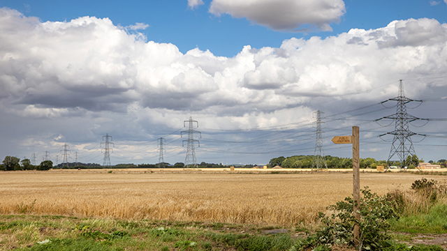
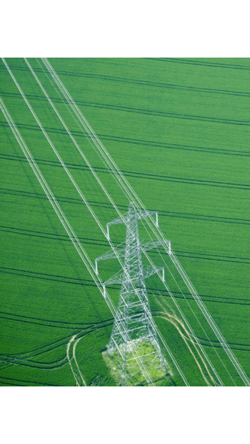
Overhead lines
.png")
In line with our statutory duties and existing and emerging Government policy, as set out in the National Policy Statements, our starting assumption when we need to add a new route to the network, is to look for a corridor for a new overhead line.
Overhead electricity transmission lines, typically involve building new steel lattice pylons to support the wires (conductors). The size, height and spacing of pylons are determined by safety, topographical, operational and environmental considerations. A typical 400 kV pylon is around 50 metres tall.
The main impact of overhead lines is generally considered to be visual, with effects on landscape and views.
Underground cables

In line with the National Policy Statements, we may propose using underground cables in sensitive areas, such as National parks or Areas of Outstanding Natural Beauty (AONB), to reduce visual impact.
For installing cables underground a large cable swathe is required. This is typically between 65 and 120 metres wide depending on the number and size of cables to be installed, with additional working areas beyond this. Once the cables have been installed, the construction swathe will be reinstated and normal agricultural practices can be resumed. Trenchless crossing techniques, such as horizontal directional drilling, are sometimes used to install cables under constraints such as rivers or major roads. Should these techniques be required, larger working areas may be necessary.
Joint bays would also be needed at intervals of approximately 500 metres to 1,000 metres to allow for the individual sections of cable to be joined together. In these areas a wider corridor swathe may be needed. The work required to bury cables would likely affect archaeology, vegetation and wildlife along the construction corridor.
Cable sealing end compounds
.png")
Cable sealing end compounds would be required where underground cables join to an overhead line. These sealing end compounds are generally around 30 x 80 metres, dependant on design requirements.